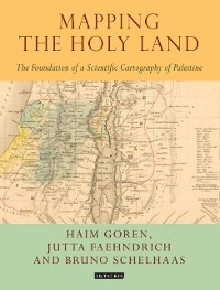
Mapping the Holy Land
The Foundation of a Scientific Cartography of Palestine
Haim Goren, Bruno Schelhaas, Jutta Faehndrich, et al.
PDF
ca. 134,75 €
Amazon
iTunes
Thalia.de
Weltbild.de
Hugendubel
Bücher.de
ebook.de
kobo
Osiander
Google Books
Barnes&Noble
bol.com
Legimi
yourbook.shop
Kulturkaufhaus
ebooks-center.de
* Affiliatelinks/Werbelinks
* Affiliatelinks/Werbelinks
Hinweis: Affiliatelinks/Werbelinks
Links auf reinlesen.de sind sogenannte Affiliate-Links. Wenn du auf so einen Affiliate-Link klickst und über diesen Link einkaufst, bekommt reinlesen.de von dem betreffenden Online-Shop oder Anbieter eine Provision. Für dich verändert sich der Preis nicht.
Links auf reinlesen.de sind sogenannte Affiliate-Links. Wenn du auf so einen Affiliate-Link klickst und über diesen Link einkaufst, bekommt reinlesen.de von dem betreffenden Online-Shop oder Anbieter eine Provision. Für dich verändert sich der Preis nicht.
Geisteswissenschaften, Kunst, Musik / Geschichte
Beschreibung
Through a detailed study of the work of three of the leading figures of the era - Augustus Petermann, Physical Geographer Royal to Queen Victoria; cartographer Charles Meredith van de Velde, who produced the finest map of the region at the time; and Edward Robinson, founder of modern Palestinology - the authors explore the complex cultural, cartographic and technical processes that shaped and determined the resulting maps of the region. Making full use of newly discovered archival material, and richly illustrated in both colour and black and white, Mapping the Holy Land is essential reading for cartographers, historical geographers, historians of mapmaking, and for all those with an interest in the Holy Land and the history of Palestine.
Weitere Titel von diesem Autor
Weitere Titel in dieser Kategorie


