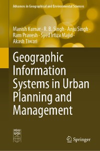
Geographic Information Systems in Urban Planning and Management
Syed Irtiza Majid, Manish Kumar, Ram Pravesh, et al.
* Affiliatelinks/Werbelinks
Links auf reinlesen.de sind sogenannte Affiliate-Links. Wenn du auf so einen Affiliate-Link klickst und über diesen Link einkaufst, bekommt reinlesen.de von dem betreffenden Online-Shop oder Anbieter eine Provision. Für dich verändert sich der Preis nicht.
Naturwissenschaften, Medizin, Informatik, Technik / Geografie
Beschreibung
Geographic Information Systems (GIS) play a pivotal role in the field of urban planning and management and provide better solutions for numerous urban problems. With GIS, one has the ability to better understand existing requirements of a city and its design to fulfill those needs.
This book contributes to developing scientific knowledge based on geospatial technologies among planners, researchers, scientists, professionals, students, and laymen and providing them with better understanding for urban planning and management at various levels. The book manifests the importance of GIS in better understanding of current urban challenges and provides new insights on how to apply GIS in urban planning. It also encourages the various stakeholders of society to participate in the decision-making process and assists planners and authorities to formulate suitable plans for sustainable urban growth of a region.
The book is divided into two parts. The first part describes thefundamental concepts of GIS and also deals with the advanced techniques of spatial planning. The second part addresses real-world case studies using various applications of GIS. The case studies include urban land-use changes, simulation of future urban growth, urban heat island, alternate landfill site selection and urban flood susceptibility mapping, among others. This book shows how to integrate GIS with remote sensing, geostatistics, artificial intelligence-machine learning techniques, and other cutting-edge technologies. Readers find this book to be an invaluable resource for understanding and solving problems relating to sustainable urban planning and management.
Kundenbewertungen
Geographic Information System, Urban geography and urbanism, Urban spatial decision support system, Geospatial technology, Open source software, Urban problem, Sustainable urban growth, Urban planning and management


